Wind chill a big player with this cold blast
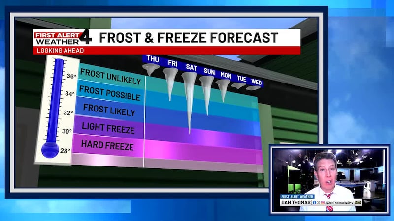
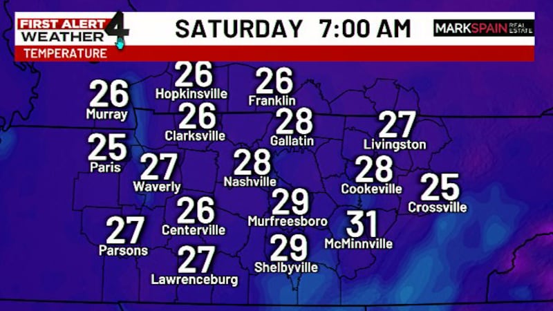
The coldest air will take hold on Saturday and Sunday mornings.
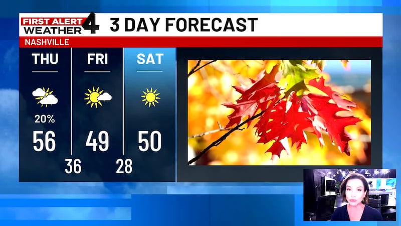
NASHVILLE, Tenn. (WSMV) - A passing sprinkle or shower is possible on Thursday.
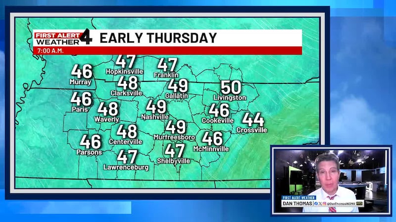
Much colder air will move in during the next couple of days. A gusty northwest breeze will make for a wind chill and enhance the cold feel in the air.
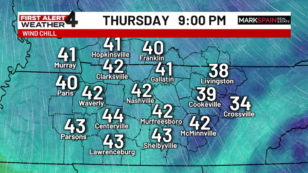
While Thursday will be a chilly day, it’ll feel significantly colder Friday morning. We’ll have lows in the mid 30s then and a wind chill ranging from the upper 20s to low 30s. Dress for winter starting late Thursday night, and certainly on Friday.
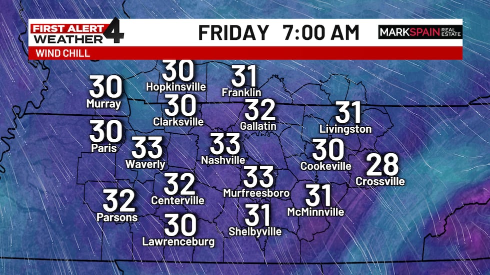
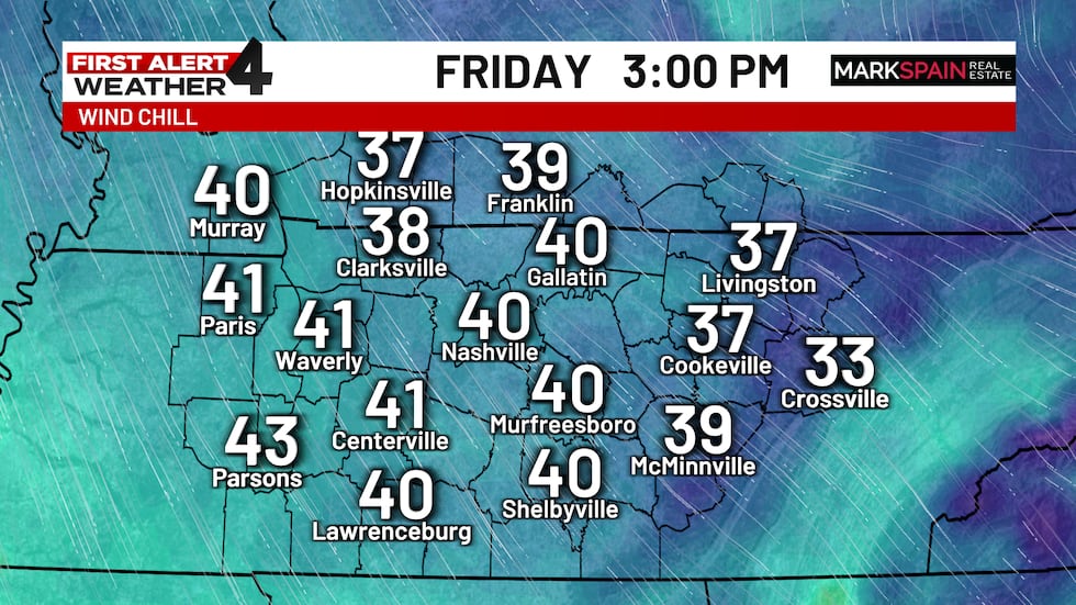
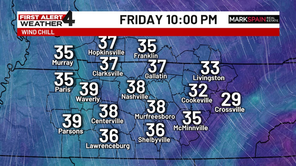
Bitterly cold weather will set up shop Friday night through early Saturday. As the wind settles down some, the temperature will drop even further. Both weekend mornings will begin in the 20s, so a freeze is expected for all.

For life-saving weather alerts, customized messages on conditions and forecasts, and videos detailing upcoming weather events, download the WSMV 4 First Alert Weather app for iPhone or Android. Have weather pictures or videos? Share them here.