Winter weather tool kit to navigate dangerous cold
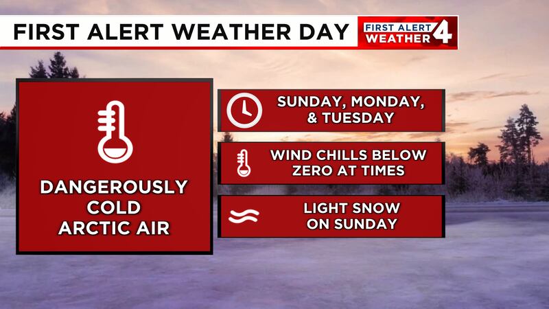
NASHVILLE, Tenn. (WSMV) - A First Alert Weather Day is in effect for Sunday, Monday, Tuesday and Wednesday Jan. 19-22 as the coldest air of the season settles in.
On Sunday some snow flurries are expected, especially east of I-65 in the Cumberland Plateau with an inch of snow accumulation possible.
First Alert Weather
Travel impacts:
According to WSMV4 meteorologist Melanie Layden, the biggest travel impact will be Sunday with the snow.
The rest of the days could be dry, however, there could be a little more snow, again in the Cumberland Plateau on Monday.
Sunday morning several wrecks were reported around the Mid State including Montgomery County, Robertson County and Lebanon.
Law enforcement across Middle Tennessee are saying bridges and overpasses tend to ice over before roadways.
Law enforcement agencies said that if you have to drive on Sunday to use extreme caution.
The Tennessee Department of Transportation’s SmartWay map provides motorists with a real-time look at the roadways across the state, including major impacts, incidents, construction, and more. WSMV4 also has a traffic map that gives motorists a look at real-time traffic times.
Power Outages:
These maps will give you the latest up-to-date information about outages in your area:
- Nashville Electric Service
- Middle Tennessee Electric
- Dickson Electric
- Cumberland Electric Membership Corporation
- CDE Lightband
Middle Tennessee Emergency Management Offices:
You can report damage or request assistance at emergency management offices in Middle Tennessee here. If you have an emergency, call 911.
Cold Weather shelters/warming stations:
Metropolitan Nashville and its surrounding counties are activating cold weather shelters and warming stations as significant cold air is expected this week in Middle Tennessee. Find shelters here.
Copyright 2025 WSMV. All rights reserved.